
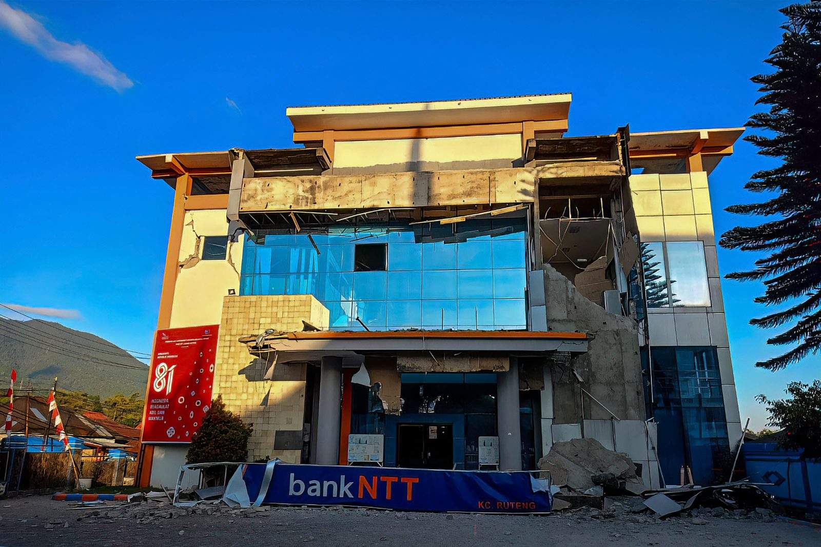
A powerful magnitude 7.7 earthquake struck off the coast of Indonesia early Saturday, resulting in the collapse of buildings and homes, and leading to at least five confirmed fatalities. The quake, which occurred in a region known for its seismic activity, has raised concerns about safety and emergency preparedness among local residents.
Details of the Earthquake
The earthquake hit Indonesia’s Flores region at a depth of 10 kilometers at 5:58 a.m. local time. According to the U.S. Geological Survey, the epicenter was located 68 kilometers (42 miles) north-northwest of Ende in East Nusa Tenggara province. Following the initial quake, several aftershocks were reported.
Impact on Local Communities
Preliminary reports from the Maumere Search and Rescue Agency indicated that at least two residents were killed and two others injured due to severe damage caused by the earthquake. Footage from local television showed patients being evacuated from hospitals as a precautionary measure. Hospital staff moved essential equipment outdoors and set up temporary treatment areas to accommodate emergency conditions.
Eyewitness Accounts
The tremors were felt across much of Flores Island, with residents reporting significant damage. Yohanna Embu, a local resident, described how many buildings were affected, stating, “I saw that the waiting room at the port terminal in Maumere had collapsed.”
At St. Peter Major Seminary in Sikka, students attending morning Mass fled in panic when the roof of an assembly hall collapsed. The rector of the seminary, Rev. Guidelbertus Tanga, reported that at least one priest suffered a broken leg after jumping from the second floor during the quake.
Tsunami Warning Issued and Lifted
In response to the earthquake, Indonesian authorities issued a tsunami warning for parts of East Nusa Tenggara, West Nusa Tenggara, South Sulawesi, and Southeast Sulawesi provinces, urging residents to evacuate to higher ground. However, the warning was later lifted when Indonesia’s Meteorology, Climatology and Geophysics Agency reported no significant sea-level changes that would pose a threat to coastal communities.
Indonesia’s Earthquake History
Indonesia, an archipelago of over 17,000 islands, is situated on the “Ring of Fire,” an area known for its high seismic activity due to tectonic plate movements. The country has experienced devastating earthquakes in the past, including a 1992 quake that triggered a tsunami, killing approximately 2,500 people on Flores Island. In 2018, a magnitude 7.5 earthquake caused a localized tsunami that devastated coastal areas and resulted in over 4,400 fatalities.
In December 2004, a massive magnitude 9.1 earthquake off the coast of Sumatra led to a tsunami that claimed the lives of 230,000 people across a dozen countries, highlighting the region’s vulnerability to such natural disasters.



Deja una respuesta